Where was the land of Andrew Hughes?
In one of my recent posts, I reported that my 4th great grandfather, Andrew Hughes (1755-1843) settled on 600 acres of land “on the south fork of Brush Creek” in the Ninety-Six District of South Carolina in 1787.
This information is included in a record that I obtained from the S.C. Department of Archives and History. Unfortunately, that record does not provide a description that enables me to figure out exactly where those 600 acres were.
Since then, I have received another document from the South Carolina Archives for 640 acres of land on “Brush Creek” (now known as Brushy Creek) that belonged to a man named Charles Hughes (I’m not sure if he’s related to Andrew, or not). That document, from the year 1791, includes a drawing that shows where this plot of land was. It also includes a notation, written just to the east of the Charles Hughes tract, that says “Andw. Hughes Land.”
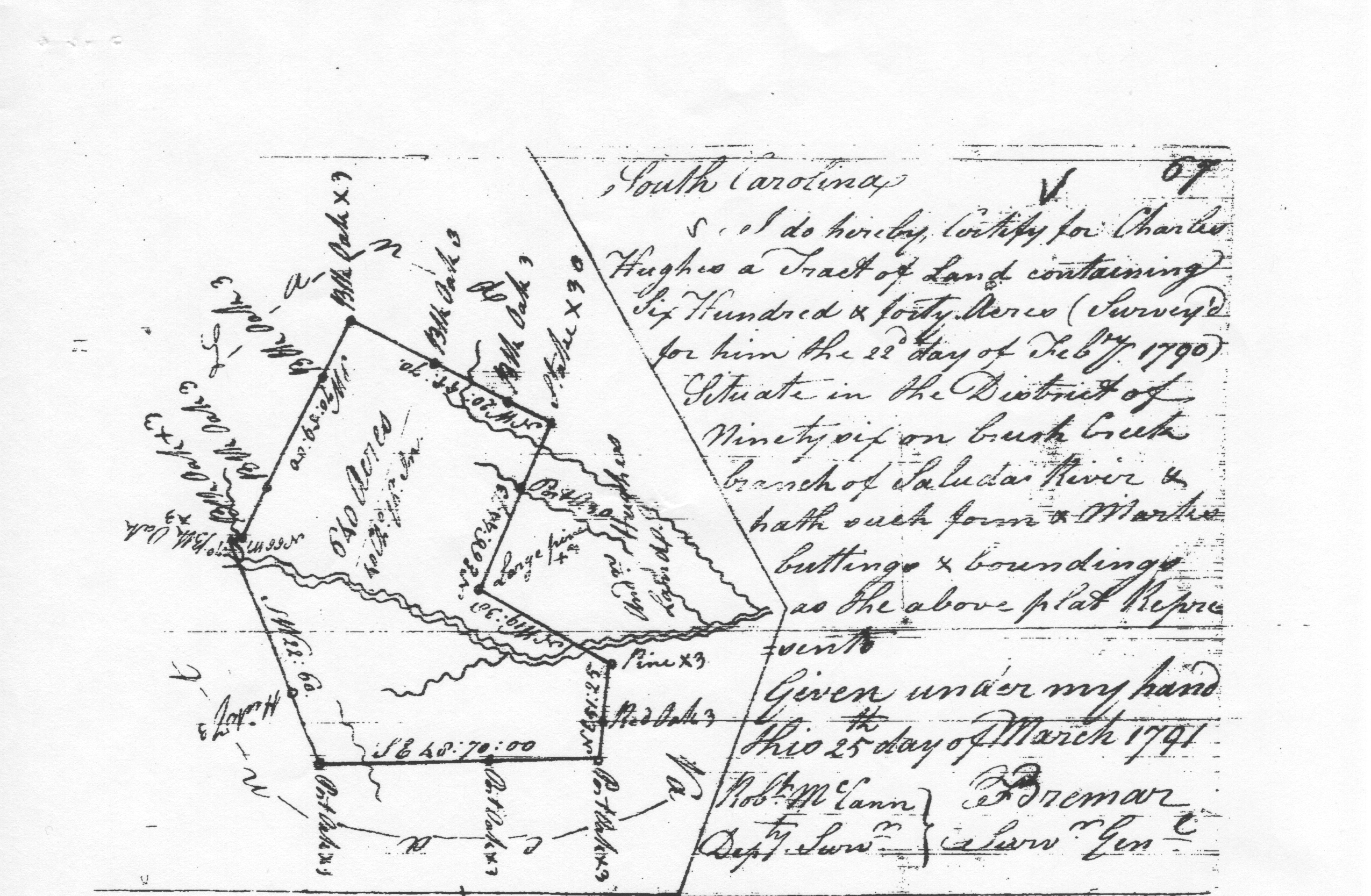
Using the information reported in this document, my brother, Brian Hughes, created this image that shows where he thinks the land of Charles Hughes might have been:
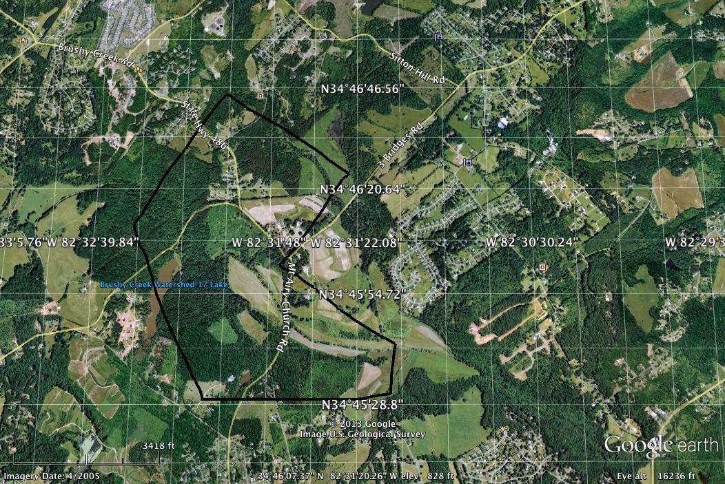
If my brother is correct, then the land of Andrew Hughes was likely located close to the current intersection of Mt. Airy Church Road and 3 Bridges Road in Anderson County.
Do you have good, accurate information that either supports or contradicts my brother’s educated guess about the location of the land? If so, I’d love to hear from you! E-mail me at tahughesnc@gmail.com.

I love the use of modern satellite images to track down old family land. The bureau of land management just added this feature to its website and land patents database.
That was my brother’s doing — I need to get him to show me how!
[…] to a man named Andrew Hughes, who did indeed fight in the Revolutionary War with a militia unit, who lived within a few miles of the cemetery from 1787 until his death in 1843, and who had a son named Micajah. According to this version of […]